Read this profile of Michigan to learn about the state's history, points of interest, and government. Also find interesting facts about each state, including the state's motto, symbols, and when it entered the union.
Grades:
5
6
7
8
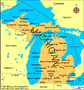
Map of Michigan

Capital: Lansing

State abbreviation: Mich.

Postal code: MI

Population est.: 10,120,860

Largest City (2005 est.): Detroit, 886,671

Land area: 56,804 sq mi. (147,122 sq km)

U.S. Representatives: 15

Entered Union (rank): Jan. 26, 1837 (26)

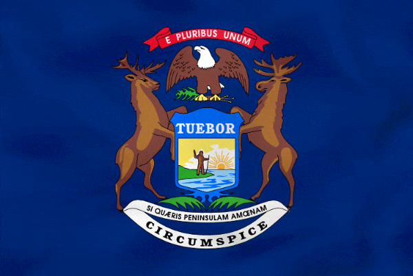
Motto: Si quaeris peninsulam amoenam circumspice (If you seek a pleasant peninsula, look around you)

Origin of name: From Indian word "Michigana" meaning "great or large lake"

State symbols:

flower: apple blossom
bird: robin
song: NA
tree: white pine

Nickname: Wolverine State

Residents: Michigander, Michiganian, Michiganite

Did you know: Battle Creak, Michigan, produces the most cereal in America

Map of Michigan

History

Indian tribes were living in the Michigan region when the first European, Étienne Brulé of France, arrived in 1618. Other French explorers, including Jacques Marquette, Louis Joliet, and Sieur de la Salle, followed, and the first permanent settlement was established in 1668 at Sault Ste. Marie. France was ousted from the territory by Great Britain in 1763, following the French and Indian Wars.

After the Revolutionary War, the U.S. acquired most of the region, which remained the scene of constant conflict between the British and U.S. forces and their respective Indian allies through the War of 1812.

Bordering on four of the five Great Lakes, Michigan is divided into Upper and Lower peninsulas by the Straits of Mackinac, which link lakes Michigan and Huron. The two parts of the state are connected by the Mackinac Bridge, one of the world's longest suspension bridges. To the north, connecting lakes Superior and Huron, are the busy Sault Ste. Marie Canals.

While Michigan ranks first among the states in production of motor vehicles and parts, it is also a leader in many other manufacturing and processing lines, including prepared cereals, machine tools, airplane parts, refrigerators, hardware, and furniture.

The state produces important amounts of iron, copper, iodine, gypsum, bromine, salt, lime, gravel, and cement. Michigan's farms grow apples, cherries, beans, pears, grapes, potatoes, and sugar beets. Michigan's forests contribute significantly to the state's economy, supporting thousands of jobs in the wood-product, tourism, and recreation industries. With 10,083 inland lakes and 3,288 mi of Great Lakes shoreline, Michigan is a prime area for both commercial and sport fishing.

Points of interest are the automobile plants in Dearborn, Detroit, Flint, Lansing, and Pontiac; Mackinac Island; Pictured Rocks and Sleeping Bear Dunes National Lakeshores; Greenfield Village in Dearborn; and the many summer resorts along both the inland lakes and Great Lakes.

Featured Middle School Resources

Exit Tickets for Middle School Classrooms

ASSESSMENT

Exit Tickets for Middle School Classrooms

Exit tickets are a form of assessment that are often used informally to assess how well students grasped a lesson, what ...

Add to Folder
creative writing
children's book
activities
classroom tools
language arts and writing
vocabulary
Create new folderCREATE NEW FOLDER
Geography Activities for Middle School

CHOICE BOARDS

Geography Activities for Middle School

Help students explore the world and develop their geography knowledge with this packet of geography activities for middl...

Add to Folder
creative writing
children's book
activities
classroom tools
language arts and writing
vocabulary
Create new folderCREATE NEW FOLDER
Test Prep Strategies and Practice for Students

ACTIVITIES

Test Prep Strategies, Tools, and Practice Questions

Help set your students up for academic success with this packet of test-taking tips, test preparation strategies, and pr...

Add to Folder
creative writing
children's book
activities
classroom tools
language arts and writing
vocabulary
Create new folderCREATE NEW FOLDER

Related Resources

REFERENCE

Indiana

Capital: Indianapolis State abbreviation: Ind. Postal code: IN Population est.: 6,271,973 Largest City (2005 est.

Add to Folder
creative writing
children's book
activities
classroom tools
language arts and writing
vocabulary
Create new folderCREATE NEW FOLDER

REFERENCE

Maine

Capital: Augusta State abbreviation: Maine Postal code: ME Population est.: 1,321,505 Largest City (2005 est.

Add to Folder
creative writing
children's book
activities
classroom tools
language arts and writing
vocabulary
Create new folderCREATE NEW FOLDER

REFERENCE

Maryland

Capital: Annapolis State abbreviation: Md. Postal code: MD Population est.: 5,600,388 Largest City (2005 est.

Add to Folder
creative writing
children's book
activities
classroom tools
language arts and writing
vocabulary
Create new folderCREATE NEW FOLDER

REFERENCE

Massachusetts

Capital: Boston State abbreviation: Mass. Postal code: MA Population est.: 6,398,743 Largest City (2005 est.

Add to Folder
creative writing
children's book
activities
classroom tools
language arts and writing
vocabulary
Create new folderCREATE NEW FOLDER

REFERENCE

New Mexico

Capital: Santa Fe State abbreviation: N.M. Postal code: NM Population est.: 1,928,384 Largest City (2005 est.

Add to Folder
creative writing
children's book
activities
classroom tools
language arts and writing
vocabulary
Create new folderCREATE NEW FOLDER

REFERENCE

Texas

Capital: Austin State abbreviation: Tex. Postal code: TX Population est.: 22,859,968 Largest City (2005 est.

Add to Folder
creative writing
children's book
activities
classroom tools
language arts and writing
vocabulary
Create new folderCREATE NEW FOLDER
loading gif