Read this profile of Indiana to learn about the state's history, points of interest, and government. Also find interesting facts about each state, including the state's motto, symbols, and when it entered the union.
Grades:
5
6
7
8
Map of Indiana

Capital: Indianapolis

State abbreviation: Ind.

Postal code: IN

Population est.: 6,271,973

Largest City (2005 est.): Indianapolis, 784,118

Land area: 35,867 sq mi. (92,896 sq km)

U.S. Representatives: 9

Entered Union (rank): Dec. 11, 1816 (19)

Motto: The Crossroads of America

Origin of name: Meaning "land of Indians"

State symbols:

flower: peony
bird: cardinal
song: "On the Banks of the Wabash, Far Away"
tree: tulip tree

Nickname: Hoosier State

Residents: Indianan, Indianian, Hoosier

Did you know: Indiana is home to the famous car race, the Indy 500

Map of Ind.

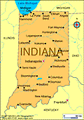
History

First explored for France by Robert Cavelier, Sieur de la Salle, in 1679-1680, the region figured importantly in the Franco-British struggle for North America that culminated with British victory in 1763. George Rogers Clark led American forces against the British in the area during the Revolutionary War and, prior to becoming a state, Indiana was the scene of frequent Indian uprisings until the victories of Gen. Anthony Wayne at Fallen Timbers in 1794 and Gen. William Henry Harrison at Tippecanoe in 1811.

During the 19th century, Indiana was the site of several experimental communities, including those established by George Rapp and Robert Owen at New Harmony.

Indiana's 41-mile Lake Michigan waterfront—one of the world's great industrial centers—turns out iron, steel, and oil products. Products include automobile parts and accessories, mobile homes and recreational vehicles, truck and bus bodies, aircraft engines, farm machinery, and fabricated structural steel. Wood office furniture and pharmaceuticals are also manufactured.

The state is a leader in agriculture with corn the principal crop. Hogs, soybeans, wheat, oats, rye, tomatoes, onions, and poultry also contribute heavily to Indiana's agricultural output.

Much of the building limestone used in the U.S. is quarried in Indiana, which is also a large producer of coal. Other mineral commodities include crushed stone, cement, and sand and gravel.

Wyandotte Cave, one of the largest in the U.S., is located in Crawford County in southern Indiana, and West Baden and French Lick are well known for their mineral springs. Other attractions include Indiana Dunes National Lakeshore, Indianapolis Motor Speedway, Lincoln Boyhood National Memorial, and the George Rogers Clark National Historical Park.
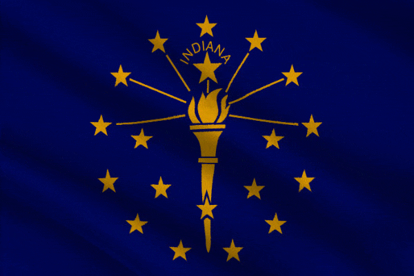
Featured Middle School Resources

Geography Activities for Middle School

CHOICE BOARDS

Geography Activities for Middle School

Help students explore the world and develop their geography knowledge with this packet of geography activities for middl...

Add to Folder
creative writing
children's book
activities
classroom tools
language arts and writing
vocabulary
Create new folderCREATE NEW FOLDER
Test Prep Strategies and Practice for Students

ACTIVITIES

Test Prep Strategies, Tools, and Practice Questions

Help set your students up for academic success with this packet of test-taking tips, test preparation strategies, and pr...

Add to Folder
creative writing
children's book
activities
classroom tools
language arts and writing
vocabulary
Create new folderCREATE NEW FOLDER
Exit Tickets for Middle School Classrooms

ASSESSMENT

Exit Tickets for Middle School Classrooms

Exit tickets are a form of assessment that are often used informally to assess how well students grasped a lesson, what ...

Add to Folder
creative writing
children's book
activities
classroom tools
language arts and writing
vocabulary
Create new folderCREATE NEW FOLDER

Related Resources

REFERENCE

Maine

Capital: Augusta State abbreviation: Maine Postal code: ME Population est.: 1,321,505 Largest City (2005 est.

Add to Folder
creative writing
children's book
activities
classroom tools
language arts and writing
vocabulary
Create new folderCREATE NEW FOLDER

REFERENCE

Maryland

Capital: Annapolis State abbreviation: Md. Postal code: MD Population est.: 5,600,388 Largest City (2005 est.

Add to Folder
creative writing
children's book
activities
classroom tools
language arts and writing
vocabulary
Create new folderCREATE NEW FOLDER

REFERENCE

Massachusetts

Capital: Boston State abbreviation: Mass. Postal code: MA Population est.: 6,398,743 Largest City (2005 est.

Add to Folder
creative writing
children's book
activities
classroom tools
language arts and writing
vocabulary
Create new folderCREATE NEW FOLDER

REFERENCE

Michigan

Capital: Lansing State abbreviation: Mich. Postal code: MI Population est.: 10,120,860 Largest City (2005 est.

Add to Folder
creative writing
children's book
activities
classroom tools
language arts and writing
vocabulary
Create new folderCREATE NEW FOLDER

REFERENCE

New Mexico

Capital: Santa Fe State abbreviation: N.M. Postal code: NM Population est.: 1,928,384 Largest City (2005 est.

Add to Folder
creative writing
children's book
activities
classroom tools
language arts and writing
vocabulary
Create new folderCREATE NEW FOLDER

REFERENCE

Texas

Capital: Austin State abbreviation: Tex. Postal code: TX Population est.: 22,859,968 Largest City (2005 est.

Add to Folder
creative writing
children's book
activities
classroom tools
language arts and writing
vocabulary
Create new folderCREATE NEW FOLDER
loading gif