MAPS
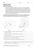
Develop students' map reading skills with this Earth science worksheet. After reading a paragraph about contour lines,…
WORKSHEETS
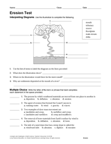
Multiple-choice and written-response questions in this Earth science exam are used to test students' knowledge and…
A chart listing the highest mountain peaks in the United States.
A brief explanation of the North American continental divide.
The following table lists the approximate land area, highest elevation, and lowest elevation of the world's continents,…
REFERENCE
All 14 of the world's tallest peaks are located in the Himalaya or the Karakoram ranges in Asia.
Learn about interesting caves and caverns of the world, including Aggtelek in Hungary, Blue Grotto in Italy, Kent's…
Ask students to identify, label, and color the landforms made by glaciers in this picture.
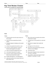
Use this printable crossword puzzle to review physical geology and key terms related to erosion.