MAPS
This 40-minute latitude and longitude lesson plan will help students understand how latitude and longitude are used to…
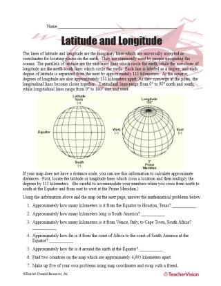
Latitude and longitude are imaginary lines universally accepted as coordinates for locating places on Earth. Students…
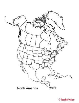
This black and white outline map features North America, and prints perfectly on 8.5 x 11 paper. It can be used for…
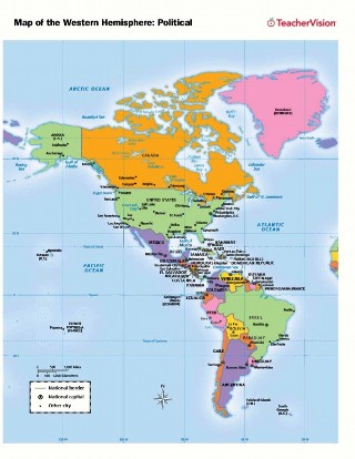
Use this printable map with your students to provide a political and physical view of the Western Hemisphere. After…
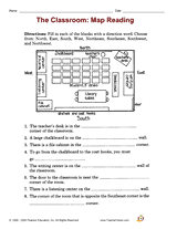
A great hands-on, supplemental activity to a map skills unit! A simple geography printable gives your class the chance…
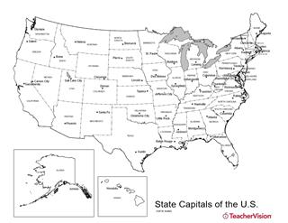
Birmingham or Montgomery? Austin or Houston? Detroit or Lansing? This U.S. map with state capitals is a great way to…
This printable outline map of the world provides a latitude and longitude grid. Use this social studies resource to help…
Introduce students to the history and locations of the Modern Olympic Games.
Distribute this printable worksheet that is to be used as a supplement to the Latitude and Longitude Lesson Plan.…
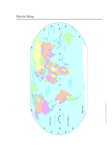
Use this printable colorful map with your students to provide a physical view of the world. After learning about this…
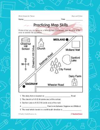
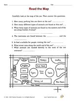
Employ with your students a printable reading activity that helps builds their skills in reading maps. Students will…
Employ this printable reading activity with your students that will help them build map reading and deductive reasoning…