MAPS
Increase social studies skills with an activity that focuses on compass directions.
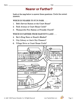
Increase social studies skills with an activity that focuses on using information from a map to determine distance.
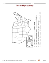
Increase social studies skills with an activity that focuses on recognizing the U.S. and locating the states.
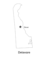
This printable black and white state map of Delaware includes the location of the capital city. Students can print,…
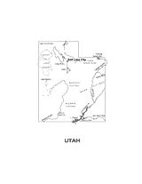
This printable black and white state map of Utah includes all of the physiographic features for the state, and can be…
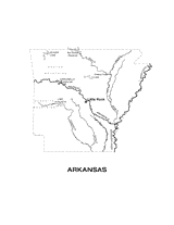
Help students understand the landform features of the U.S. state of Arkansas with this printable physiographic Arkansas…
Expand your pupils' knowledge of world geography with this printable activity. Pupils will find and label the major…
By reading a special purpose map, and reading and writing numbers, children will recognize the importance of being…
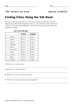
Use this printable to teach children how to use latitude and longitude to locate places on a map.
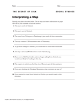
Children will identify the different places described in this printable by looking at a map.