MAPS
A brief explanation of the North American continental divide.
Do you know what language is spoken in Belize? Look at this chart to find the answer to that question and what languages…
Learn about the Geography Hall of Fame with information on the world's largest continent, longest lagoon, and more!
The following table lists the approximate land area, highest elevation, and lowest elevation of the world's continents,…
Learn about the differences between climate maps, topographic maps, and others types of maps.
Explore connections in mathematics and nature with this article on the Equator.
Enhance social studies units with the geography transparencies and visuals in this slideshow. Printable maps on…
ACTIVITIES
Students are asked to identify the location of cities on a map and determine the distances between them. Assesses their…
EDITOR'S COLLECTIONS
Enhance your geography lessons with printable maps of the United States. The maps in this gallery depict U.S. regions,…
Challenge children to identify which countries have changed their names with this classroom game.
Test your pupils' knowledge of the seven continents with this printable geography quiz.
Expand pupils' knowledge of the countries of the world by giving them this printable quiz.
Introduce pupils to the national flags of other countries with this printable geography quiz.
Give students practice with maps as they study the structure of the Earth. In this printable, students will analyze a…
Review Earth's structure and the meaning of map symbols with this vocabulary printable and word puzzle.
Compare the functions of a map and a globe with this printable. Students must determine which geography resource would…
In this geography printable, students identify the objects needed to make a map projection and classify each projection…
Challenge students to identify map symbols and use a scale to calculate distance. In this social studies printable,…
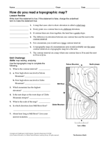
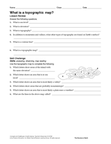
In this social studies printable, students will answer questions about topographic maps and practice map reading.
Review map symbols with this social studies printable. Students will use an atlas or other reference materials to…
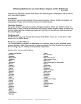
Use this printable to review the key differences between Great Britain, the United Kingdom, and England—names that are…
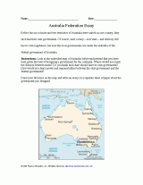
Students will review Australia's colonies before they became part of an independent nation, and think about other ways…
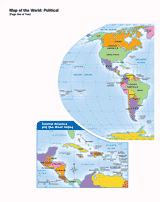
Use this printable map with your students to provide a political and physical view of the world. After learning about…
CLASSROOM TOOLS
This map will help students visualize time zones in the United States.