Read this country profile to learn about the geography, history, and government of the Independent State of Papua New Guinea, a country in Oceania.
Grades:
6
7
8
9
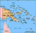
Map of Papua New Guinea
Independent State of Papua New Guinea

Sovereign: Queen Elizabeth II (1952)

Governor-General: Paulias Matane (2004)

Prime Minister: Sir Michael Somare (2002)

Current government officials

Land area: 174,849 sq mi (452,860 sq km); total area: 178,703 sq mi (462,840 sq km)

Population (2007 est.): 5,795,887 (growth rate: 2.2%); birth rate: 28.8/1000; infant mortality rate: 48.5/1000; life expectancy: 65.6; density per sq mi: 33

Capital and largest city (2003 est.): Port Moresby, 324,900

Monetary unit: Kina

Languages: Tok Pisin (Melanesian Pidgin, the lingua franca), Hiri Motu (in Papua region), English 1%-2%; 715 indigenous languages

Ethnicity/race: Melanesian, Papuan, Negrito, Micronesian, Polynesian

Religions: Roman Catholic 22%, Lutheran 16%, Presbyterian/Methodist/London Missionary Society 8%, Anglican 5%, Evangelical Alliance 4%, Seventh-Day Adventist 1%, other Protestant 10%, indigenous beliefs 34%

Literacy rate: 66% (2003 est.)

Economic summary: GDP/PPP (2007 est.): $11.94 billion; per capita $2,000. Real growth rate: 6.2%. Inflation: 1.7%. Unemployment: 1.9%up to 80% in urban areas (2005). Arable land: 0.5%. Agriculture: coffee, cocoa, copra, palm kernels, tea, sugar, rubber, sweet potatoes, fruit, vegetables, vanilla; shell fish, poultry, pork. Labor force: 3.557 million (2007 est); agriculture 85%, industry n.a., services n.a. Industries: copra crushing, palm oil processing, plywood production, wood-chip production; mining of gold, silver, and copper; crude oil production, petroleum refining; construction, tourism. Natural resources: gold, copper, silver, natural gas, timber, oil, fisheries. Exports: $4.553 billion f.o.b. (2007 est.): oil, gold, copper ore, logs, palm oil, coffee, cocoa, crayfish, prawns. Imports: $2.269 billion f.o.b. (2007 est.): machinery and transport equipment, manufactured goods, food, fuels, chemicals. Major trading partners: Australia, Japan, China, Singapore (2006).

Member of Commonwealth of Nations

Communications: Telephones: main lines in use: 63,700 (2005); mobile cellular: 75,000 (2005). Radio broadcast stations: AM 8, FM 19, shortwave 28 (1998). Radios: 410,000 (1997). Television broadcast stations: 3 (2004). Televisions: 59,841 (1999). Internet Service Providers (ISPs): 2,436 (2007). Internet users: 110,000 (2006).

Transportation: Railways: 0 km. Highways: total: 19,600 km; paved: 686 km; unpaved: 18,914 km (1996 est.). Waterways: 11,000 km (2006). Ports and harbors: Kieta, Lae, Madang, Port Moresby, Rabaul. Airports: 578 (2007).

International disputes: Indonesian secessionists, squatters, and illegal migrants create repatriation problems for Papua New Guinea.

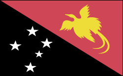
Flag of Papua New Guinea

Geography

Papua New Guinea occupies the eastern half of the island of New Guinea, just north of Australia, and many outlying islands. The Indonesian province of West Papua (Irian Jaya) is to the west. To the north and east are the islands of Manus, New Britain, New Ireland, and Bougainville, all part of Papua New Guinea. About one-tenth larger than California mountainous interior has only recently been explored. Two major rivers, the Sepik and the Fly, are navigable for shallow-draft vessels.

Government

Constitutional monarchy with parliamentary democracy.

History

The first inhabitants of the island New Guinea were Papuan, Melanesian, and Negrito tribes, who altogether spoke more than 700 distinct languages. The eastern half of New Guinea was first explored by Spanish and Portuguese explorers in the 16th century. In 1828, the Dutch formally took possession of the western half of the island (now the province of West Papua [Irian Jaya], Indonesia). In 1885, Germany formally annexed the northern coast and Britain took similar action in the south. In 1906, Britain transferred its rights to British New Guinea to a newly independent Australia, and the name of the territory was changed to the Territory of Papua. Australian troops invaded German New Guinea (called Kaiser-Wilhelmsland) in World War I and gained control of the territory under a League of Nations mandate. New Guinea and some of Papua were invaded by Japanese forces in 1942. After being liberated by the Australians in 1945, it became a United Nations trusteeship, administered by Australia. The territories were combined and called the Territory of Papua and New Guinea (PNG).

Australia granted limited home rule in 1951. Autonomy in internal affairs came nine years later, and in Sept. 1975, Papua New Guinea achieved complete independence from Britain.

A violent nine-year secessionist movement took place on the island of Bougainville. In 1989, guerrillas of the Bougainville Revolutionary Army (BRA) shut down the island's Australian-owned copper mine, a major source of revenue for the country. The rebels believed that Bougainville deserved a greater share of the earnings for its copper. In 1990, the BRA declared Bougainville's independence, whereupon the government blockaded the island until Jan. 1991, when a peace treaty was signed.

On July 17, 1998, an earthquake-triggered tsunami off the northern coast of PNG killed at least 1,500 people and left thousands more injured and homeless.

Many analysts say Papua New Guinea is in danger of political and economic collapse. The country's political system is unstable, the crime rate has soared, corruption is rampant, and essential services including health care and education continue to decline. According to the World Bank, 70% of the country lives in poverty. In 2006, Australia announced that it was gravely concerned about the country and had peacekeeping forces at the ready.

Somare was elected to a second consecutive term as prime minister in August 2007, defeating Sir Julius Chan.

Featured High School Resources

Poetry Packet for High School

ACTIVITIES

National Poetry Month Themed Packet for High School

To celebrate Poetry Month, this resource shares 3 activities that will help high school students to engage with poetry i...

Add to Folder
creative writing
children's book
activities
classroom tools
language arts and writing
vocabulary
Create new folderCREATE NEW FOLDER
Romeo and Juliet Teaching Unit Kit

LESSON PLANS

Romeo and Juliet Teaching Unit Kit

A complete teaching kit for a full or partial unit on Romeo and Juliet Take your students on a thought-provoking, insig...

Add to Folder
creative writing
children's book
activities
classroom tools
language arts and writing
vocabulary
Create new folderCREATE NEW FOLDER
lesson plans for animal farm - kit for a complete unit on the novel

LESSON PLANS

Animal Farm Teaching Unit Kit

Everything you need to teach a full or partial unit on Animal Farm Help your students dive into the modern relevance, m...

Add to Folder
creative writing
children's book
activities
classroom tools
language arts and writing
vocabulary
Create new folderCREATE NEW FOLDER

Related Resources

REFERENCE

Families of Countries

People aren't the only things with relatives; countries have them, too.

Add to Folder
creative writing
children's book
activities
classroom tools
language arts and writing
vocabulary
Create new folderCREATE NEW FOLDER

REFERENCE

Territories, Colonies, and Dependencies

Source: The World Factbook, 2005 The following is a list of dependencies-territories under the jurisdiction of another c...

Add to Folder
creative writing
children's book
activities
classroom tools
language arts and writing
vocabulary
Create new folderCREATE NEW FOLDER

REFERENCE

Women and Work

You can be most anything you want to be.

Add to Folder
creative writing
children's book
activities
classroom tools
language arts and writing
vocabulary
Create new folderCREATE NEW FOLDER

REFERENCE

Bahamas

Map of Bahamas Commonwealth of the BahamasSovereign: Queen Elizabeth II (1952)Governor-General: Arthur Dion Hanna (20...

Add to Folder
creative writing
children's book
activities
classroom tools
language arts and writing
vocabulary
Create new folderCREATE NEW FOLDER

REFERENCE

Trinidad and Tobago

Map of Trinidad and Tobago Republic of Trinidad and Tobago President: Maxwell Richards (2003) Prime Minister: Patric...

Add to Folder
creative writing
children's book
activities
classroom tools
language arts and writing
vocabulary
Create new folderCREATE NEW FOLDER

REFERENCE

Vanuatu

Map of Vanuatu Republic of VanuatuPresident: Kalkot Mataskelekele (2004)Prime Minister: Ham Lini (2004)Total area: 4,71...

Add to Folder
creative writing
children's book
activities
classroom tools
language arts and writing
vocabulary
Create new folderCREATE NEW FOLDER
loading gif